Field notes: the slope that turned a thirty-foot zone into twenty feet of real clearance
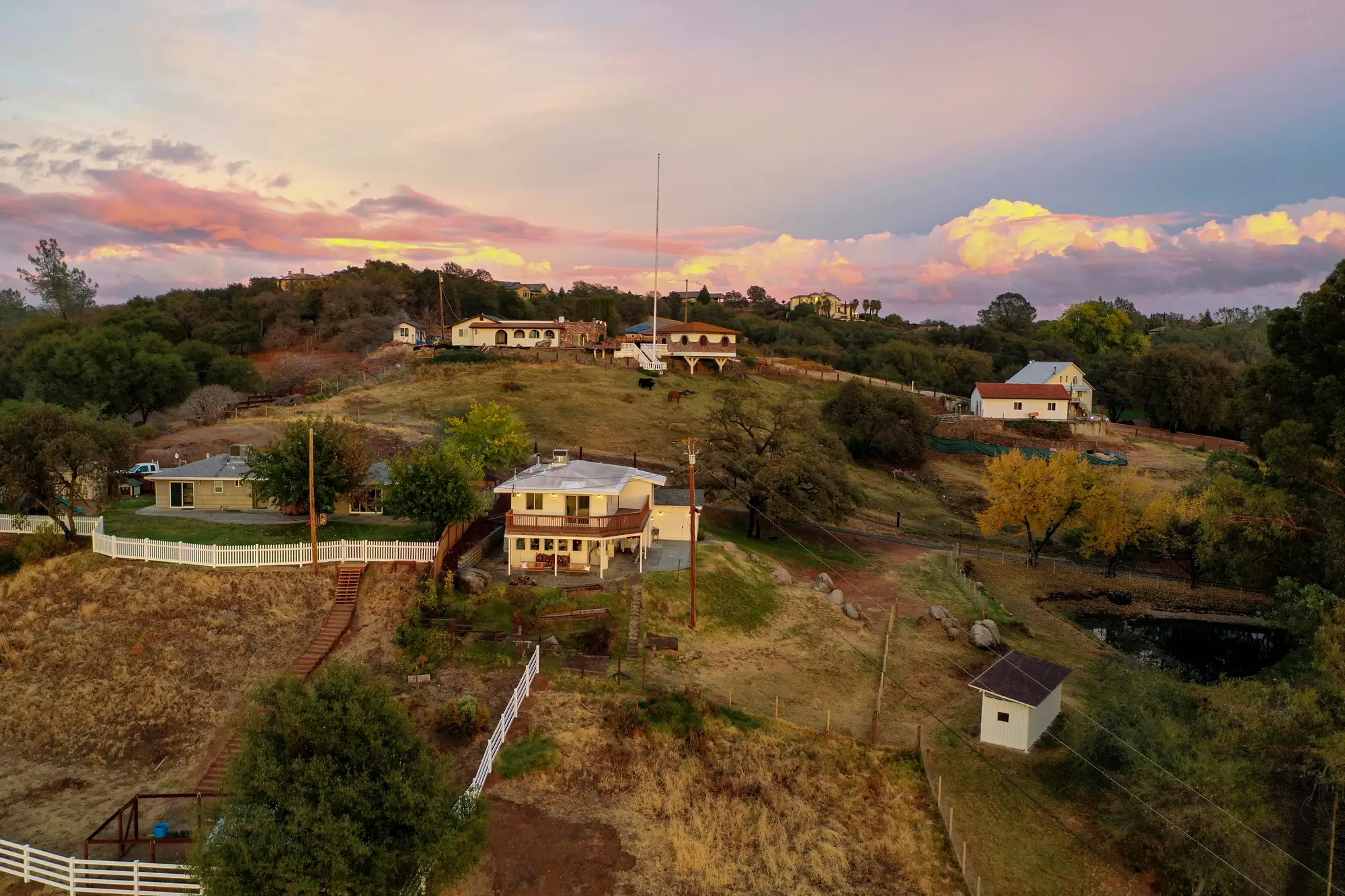
I was out on a hillside parcel above a canyon a few weeks back, the kind of lot where the house sits on a pad cut into the slope and the back thirty feet of Zone 1 just keeps dropping. The owner had done the work. Brush cleared, limbs up, grass mowed. On paper, thirty feet of defensible space, measured the way everyone measures it: tape out from the structure, flag at thirty, done.
Except that tape was running down a 35% grade, and a tape measure doesn't know the difference between flat ground and a foreslope. Thirty feet of tape on a 35% slope covers about twenty-eight feet of horizontal distance. Not a huge gap at that grade. But this lot steepened partway down, and the back half of the zone was closer to 45%, where the same thirty feet of slope distance buys you under twenty-seven feet. Stack a retaining wall offset, a property line jog, and a yard or so lost to a neighbor's overhanging oak, and the clearance that matters most for radiant heat and ember cast was sitting closer to twenty feet than thirty.
This shows up on hillside lot after hillside lot, and it's geometry that most clearance checks quietly ignore.
The defensible-space zones in code and in most carrier guidelines are written as horizontal distances from the structure. That's the right way to write them. But the instrument doing the checking, whether it's a contractor with a tape or an inspector pacing it off, usually reports slope distance, because that's what's underfoot. On flat ground the two numbers are the same and nobody thinks twice about it.
On a hillside lot, which describes a large share of the WUI parcels underwriters worry about, the gap between slope distance and horizontal distance grows with grade, and it grows fastest exactly where fire behavior is already working against the homeowner. Steep slopes preheat fuel faster on the upslope side. A zone that's nominally compliant but geometrically short, on the exact terrain where fire moves quickest, is a worse problem than the same shortfall on a flat lot.
I've started asking, on every hillside file, what slope class the zone was measured on, not just whether the acreage of clearance "looks right" from the street. A few things I keep in mind walking these:
The error isn't linear. A 20% slope only costs you about two feet of horizontal distance per thirty feet of tape. Push to 50%, and you're giving up over four feet. Above that, on the steep cut-and-fill slopes common in canyon-adjacent subdivisions, the correction stops being a rounding issue and starts being the difference between a Zone 1 that meets code and one that doesn't.
Vegetation density compounds it. A twenty-foot effective clearance with scattered grass is a different risk than twenty feet with unthinned manzanita at the edge. Slope error shrinks the zone; it doesn't tell you what's growing in what's left of it.
Renewal inspections rarely re-walk the slope. The clearance gets noted once, often by whoever cleared it, and carried forward year over year unless something flags it. Grade doesn't change, but what's regrown on it does, and the slope correction that mattered at bind still matters at renewal.
What I've wanted, honestly, is a way to check the horizontal clearance in each zone against the real slope-corrected ground, per address, without sending someone out to re-tape every hillside file on the book. That's the gap a tool like Defensible Space is built to close: it reads vegetation type, density, and clearance within each zone from imagery and reports it against the zone requirement, slope included, so the thirty feet on the file and the thirty feet on the hill are the same number.
If you're carrying hillside parcels where that gap might be living in your file right now, it's worth checking before the next renewal cycle does it for you.