Zone 0 vs. Zone 1 vs. Zone 2: what each defensible space ring requires
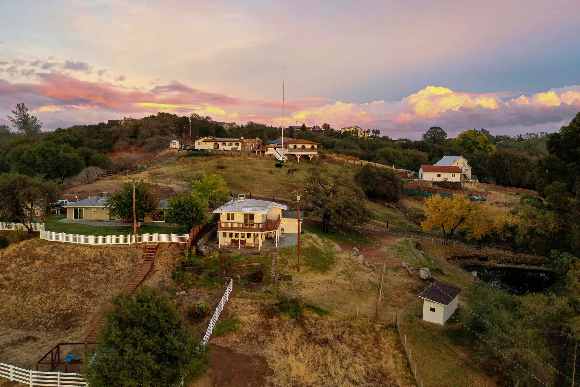
Most defensible space codes split the area around a structure into three concentric rings, and most compliance disputes trace back to someone treating those rings as interchangeable. They're not. Each zone has a different job, a different distance band, and a different standard for what "cleared" means.
The three rings, in plain terms
Zone 0 runs from the structure out to 5 feet. This is the ember-resistant zone, and the standard here is the strictest of the three: noncombustible materials only, no mulch, no stored firewood, no shrubs touching siding or decking. The logic is ember cast, not flame contact. Embers can travel a mile ahead of a fire front and land in gutters, under eaves, in a pile of bark mulch against the foundation. Zone 0 exists to deny those embers anything to catch on.
Zone 1 covers roughly 5 to 30 feet out. The old shorthand for this zone is "lean, clean, and green": plants spaced so fire can't jump crown to crown, grass kept low, dead material removed, irrigation keeping what's left from drying into fuel. This is where most residential defensible space work happens, and it's also where inspectors spend the most time arguing with homeowners about spacing.
Zone 2 extends from 30 feet out to 100 feet, sometimes further depending on slope and local ordinance. This is intermediate zone clearance, not fuel elimination. The requirement is reduced fuel volume and horizontal and vertical spacing between vegetation, not a bare lot. A homeowner who clear-cuts Zone 2 isn't meeting the standard any better than one who leaves it wild; they're just failing it a different way.
Where compliance reviews break down
The zones sound simple on paper and get messy in the field. A few things show up again and again in underwriting files and appeal hearings:
Zone 0 failures hide in plain sight. A property can look well-maintained from the curb and still have a planter box of bark mulch sitting against the siding, or a woodpile tucked under a window. Those are Zone 0 violations regardless of how clean Zone 1 and Zone 2 look, and they're often the ones that matter most for ignition risk.
Zone boundaries get measured inconsistently. Distance from the structure sounds like a simple ruler measurement, but on a sloped lot or an irregular footprint, two inspectors can draw the 30-foot line in different places. That inconsistency is a real problem when a policyholder disputes a non-renewal or a regulator asks for the basis of a score.
Vegetation regrows between inspections. Annual cadence is standard for a reason: grass that was compliant in spring can be a Zone 1 or Zone 2 fuel load by late summer, and a lot that was cleared two years ago may have canopy closure now that nobody's walked.
Why the zone, not just the acreage, is the unit that matters
An underwriter asking whether a property is defensible is really asking three separate questions, one per zone. A single aggregate score across the whole parcel buries the Zone 0 failure that actually drives loss. A per-zone read gives each ring its own number, measured against what that ring is required to do.
That's the premise behind Defensible Space: vegetation type, density, and clearance scored zone by zone from VHR imagery, so a Zone 0 ember-resistant failure doesn't get averaged away by a clean-looking Zone 2.
If you're scoring defensible-space compliance before binding, renewing, or responding to a regulator, see how a per-zone read compares to what you're measuring in the field today.